Our Latest Projects
Total Hydrographic are your certified Hydrographic Surveyors and Marine Mapping/GIS professionals.
Our Services
Bathymetric Surveys
Side Scan Sonar Surveys
Hydrographic Data Analysis
Terrestrial Surveying
Hydrographic Consultancy
See What Projects We Have Done!
Let’s Get Surveying!
Under Keel Clearance Survey case study
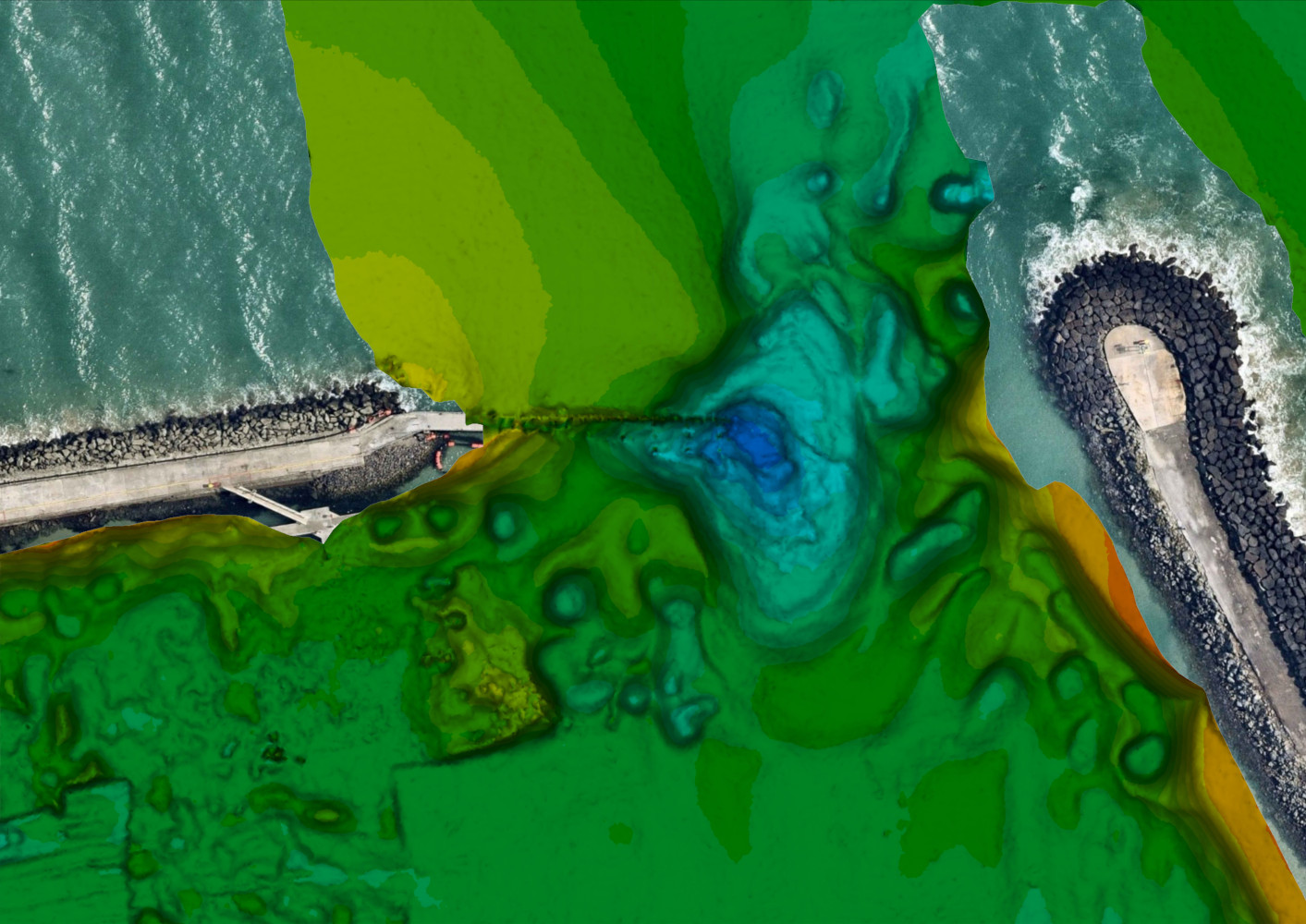
Under keel clearance in ports and harbours can be a costly and dangerous hazard if not effectively managed. With the risk of vessel’s running aground on the ocean floor, authorities typically keep on top of this by gathering bathymetric data to help make informed decisions in the management of their waters.
Hazard Detection & Debris Clearance
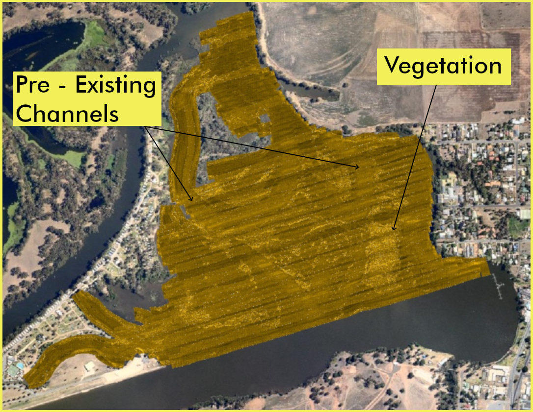
Total Hydrographic were approached with a brief to map over 35km of Inland River Waterways. The council were after survey data that could help provide them with a clear understanding of the bathymetry and the location of hazards and debris that could be a problem for recreational boating.
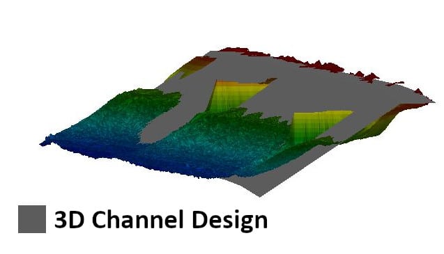
3D Channel Design
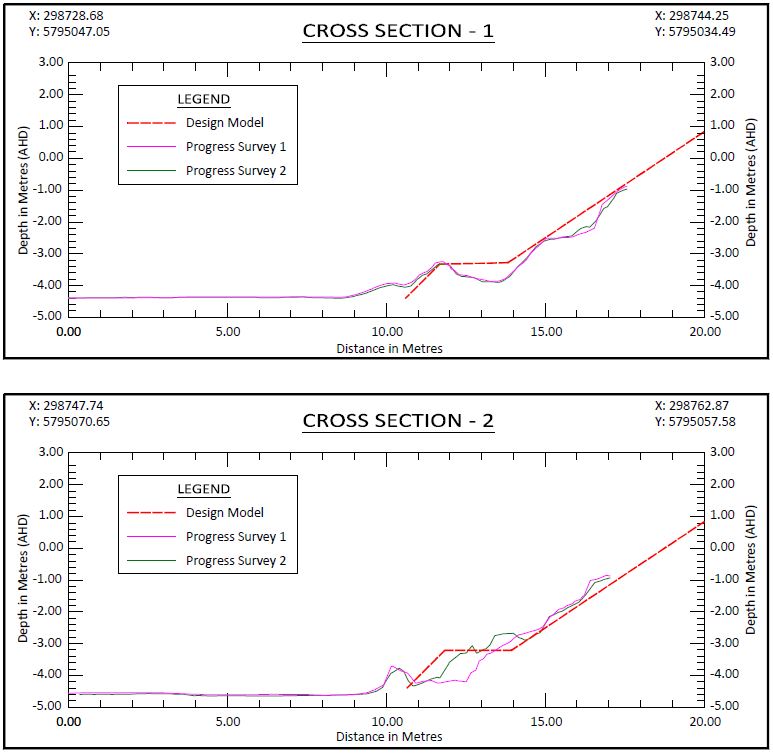
The objectives of the survey was to provide full bathymetric survey and provide a volume assessment for the renourishment site to meet the 3D design model. The data that we provided allowed the client to make an informed decision, based on quantitative and visual data presentation, as to the best mode of practice for dredging and renourishment operations.
Reservoir Study
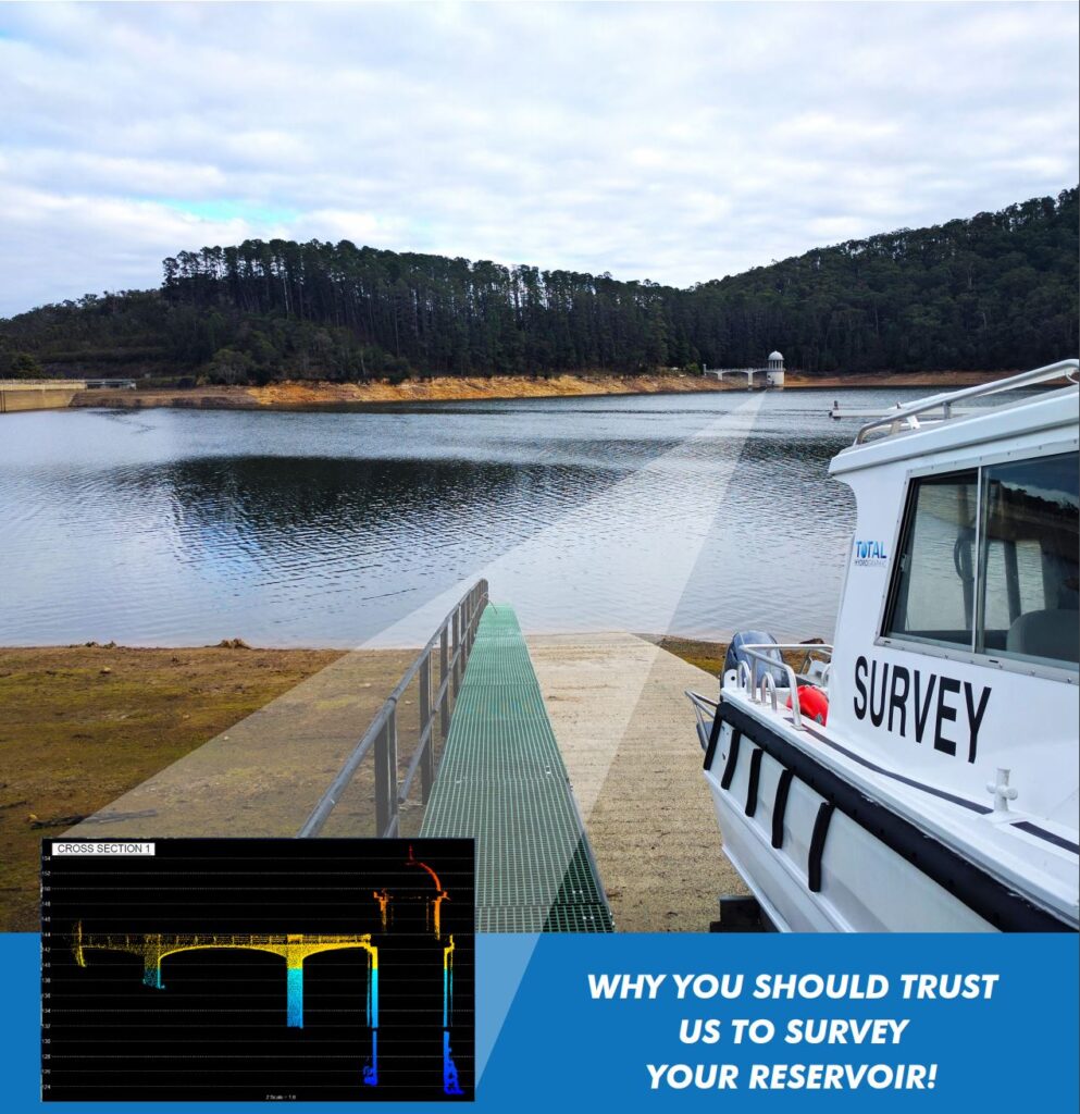
In a drought prone country like Australia, where millions of people rely on the country’s many reservoirs for a safe and dependable water supply – efficient, forward thinking and strategically planned reservoir management is crucial. The risk involved in reservoir management can be mitigated with quick access to relevant and accurate data.
Underwater Inspection Survey
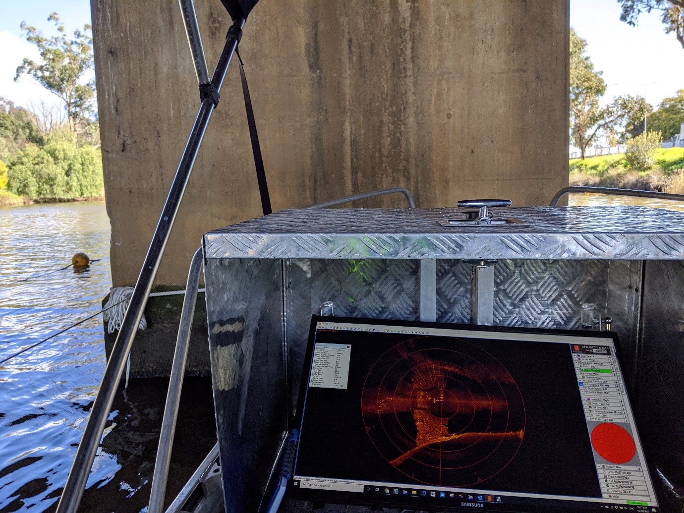
Total Hydrographic specialises in underwater survey and scanning and can utilise a variety of survey sensors to capture relevant data for clients. The Kongsberg MS1000 Mechanical Scanning Sonar used by Total Hydrographic is an example of a system that is ideal for inspecting underwater structures.
A Rockwall
Submerged Trees
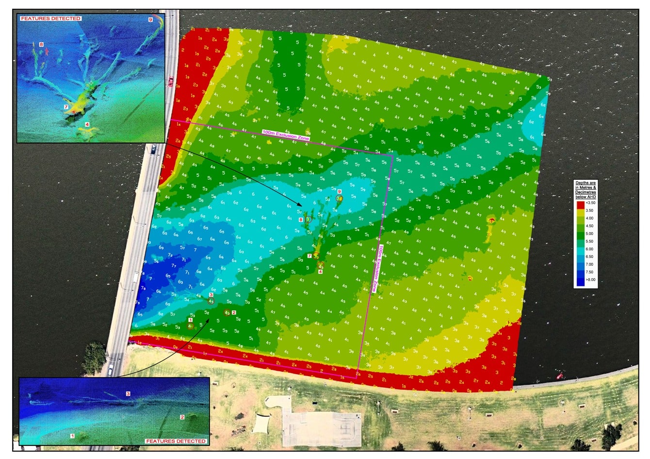
This image is an extract from a hazard clearance survey of a lake. The client needed to know that there was a minimum clearance depth of water available at particular water levels. There were many hazards on the lake bed, however the survey revealed that they were all deeper than the client’s required minimum depth.
Harbour Dredging
A corner stone of Total Hydrographic’s operations is to provide underwater survey solutions that can help Port and Harbour Authorities determine an appropriate dredging solution for their waterways. Dredging solutions often takes place because of sedimentation gradually encroaching in navigable waterways, and or when Port and Harbour authorities look to expanding their operations.
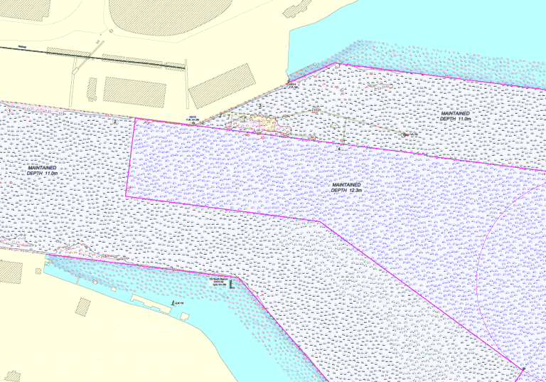
Compliance Chart
In a port environment declared channel depths take utmost importance. Quite often a port will focus their attention on whether their channel is as deep as the depth it is declared. Here we can assist by streamlining our results. A Compliance Chart provides a clean interpretation of whether depths are compliant or non-compliant.
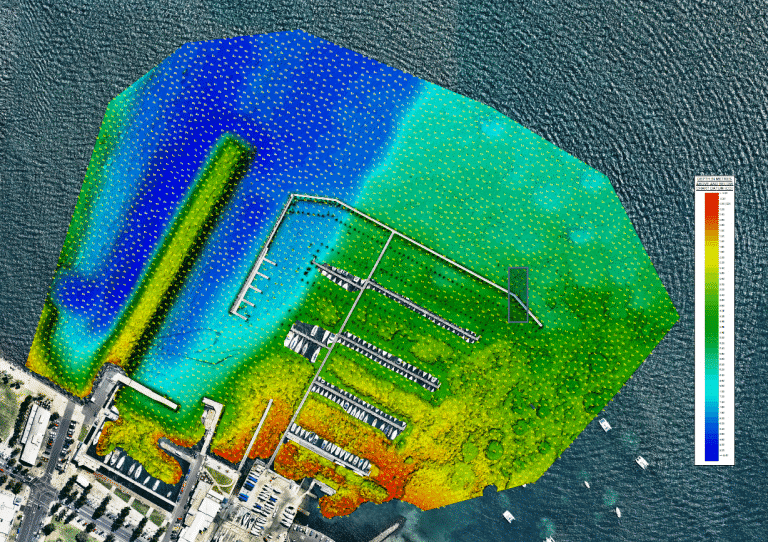
Yacht Club Survey
Multibeam survey data can be presented in many ways. 3D contours are often a great way of presenting what is happening on the seabed. This Yacht Club survey not only reveals the depths but also the old pier alignment and extensive aquatic vegetation in the southern shallows.
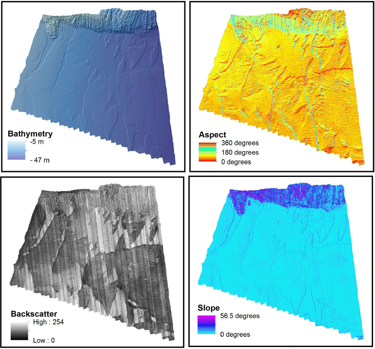
Habitat Mapping
This is an example of a habitat mapping project carried out by Total Hydrographic. An MBES survey was undertaken and then several outputs were delivered to the client. The information clearly reveals the location of the reef outcrop to the north and then the sandy bottom to the south. The backscatter highlights the variations in the seabed within the sand area outside of the reef.
Hydrography is the science of measuring and describing physical features within water bodies. Hydrography is used for navigation, habitat mapping and hazard identification.
Address
14/75 Endeavour Way, Sunshine West VIC 3020
79 Cook Road, Bli Bli, 4560, QLD

