What is Hydrographic Survey?
Part of the maritime science study is the analysis, measurements, description, and mapping of features found underwater called hydrographic survey. Bathymetric survey is the mapping of the submarine topography, known as bathymetry. Hydrographic Survey encompasses bathymetry, the shape, and features of the shoreline; the characteristics of tides, currents, and waves; and the physical and chemical properties of the water itself.
Hydrographic Surveys are the science of measuring all factors beneath the water that affect all the marine activities like dredging, marine constructions, offshore drilling etc. There are several reasons why hydrographic surveys are important, with the main purpose being for navigation. Measuring of tides for coastal work like harbour construction and construction of sea defence infrastructure. Determining the depth is used for navigation, location of rocks, sand bars and in connection with irrigation and land drainage schemes. Hydrographic Survey is used to determine areas subject to silt and scouring (the eating out of a submarine surface) and can be used to measure the quantity of water and flow of water in connection with water schemes, Power schemes and flood controls.
There are 5 fundamental requirements when completing a Hydrographic Survey, these are:
Position: Position must be known in the survey area to locate the survey information. Position can be obtained by taking or extending control from a previous survey or be established using new positions obtained from navigation satellites
Orientation: A direction or Azimuth must be known to orientate the survey. This can be established by accurately fixing at least two positions in the survey area or more traditionally by observing the Sun or other heavenly body to obtain the true bearing of the second position from the first.
Scale: The distance between at least two positions must also be known to allow the survey to be represented at a particular scale. This can be achieved by direct measurement; or by calculation if at least two positions are known.
Shape: Having established position, azimuth and scale, additional positions will allow all the detail of the survey to be fixed.
Detail: From the established framework the survey can be conducted in earnest, gathering all the required information. The following list is some of the more important details which can be recorded from this survey:
- The position of the coastline (High Water and Low Water mark)
- The nature of the bottom at regular intervals over the whole water area
- The positions of breakers, tide rips, fishing stakes, etcetera
- Lading lines fixed and carefully sounded positions of topographical detail of use to the mariner
- Tidal stream measurements
- Tidal observations
- Photographic views
- The positions of all navigation marks
- Sailing Directions checked and amended details of wrecks found, swept, etcetera
- Light characteristics measured
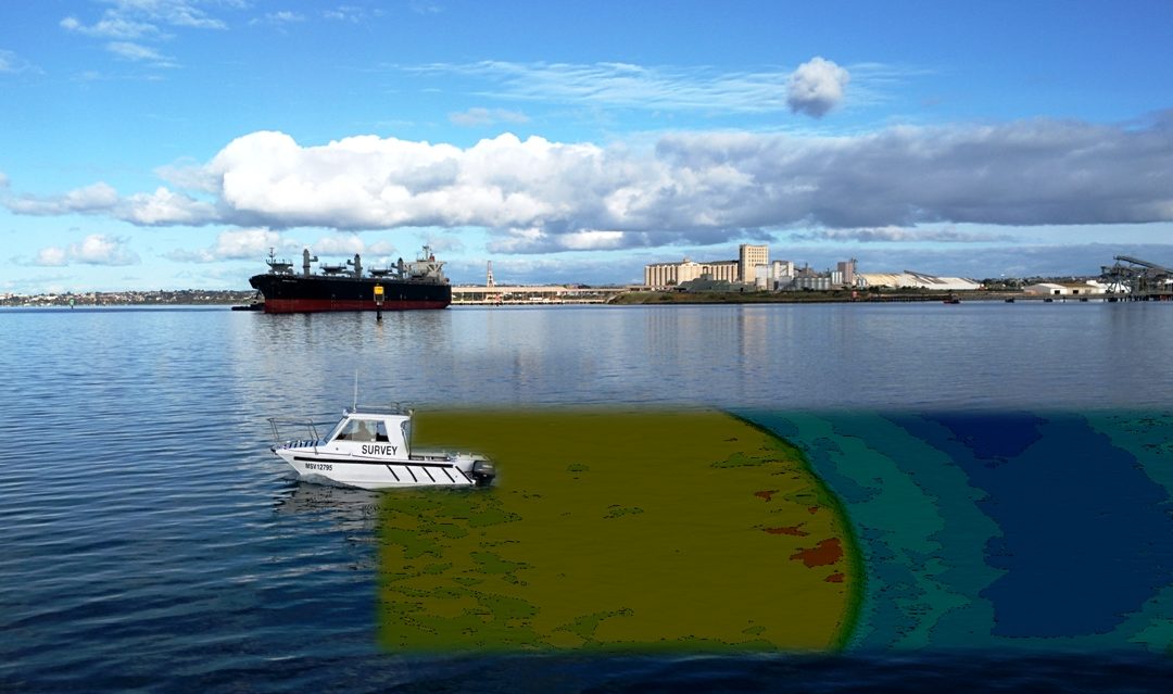
At Total Hydrographic our surveyors are specialists in Hydrographic Surveys with knowledge on conducting the survey, interpreting, and mapping the data collected and turning the hydrographic data into a product which our clients can use efficiently. The team uses small survey vessels to determine the geography of a body of water, including the depth, tide measurements, shoreline obstacles, and physical features of the submarine topography. Most of the time, we deploy a small boat with Single Beam Echo Sounder, Multibeam Echo Sounder and or Side Scan Sonar. These systems allow us to capture the bathymetry of the water body and an extremely high level of detail. Once the data is collected, we process it in our office using Hypack (specialised hydrographic software) and provide our clients Deliverables such as PDF survey plans, Nautical Chart style drawings, Interactive 3D point cloud presentations, 3D flythroughs and survey reports.
Total Hydrographic are members of SSSI and AHS. To learn more about us, the services we offer or to get a price estimate please contact us.
Recent Comments